|
hey guys,
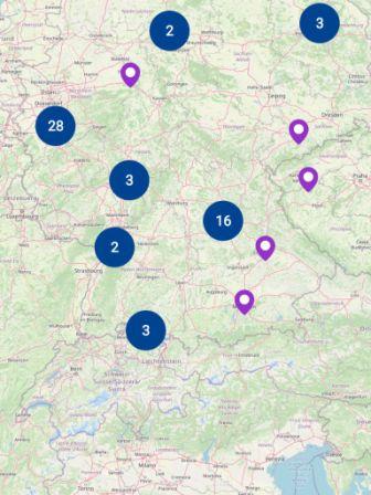
im use Open Street map i have implemented in my app where all the markers are showing with cluster and some are individuals.
here i is the image of it.
showing 5 of 6
show 1 more comments
|
|
Humanitarian OpenStreetMap Team Indonesia (HOT ID) launched a mobile application called Geo Data Collect (GDC) (on GitHub). Geo Data Collect is a mobile application used to assist you in doing the field survey. https://openstreetmap.id/en/tutorial/lainnya/aplikasi-geo-data-collect/ |


I assume you are talking about umap. This help site covers many more topics than just umap. So please make this clear in your question.
yes @escada actually i want markers list which are showing on map except cluster data do you know how can we get on load map?
Do you mean a javascript call that would return a list of markers displayed (excluding the clustered ones) ? Or a popup with that list displayed ?
I'm even sure either one is possible...
Actually i'm not use java script i implemented it in a native android in which i set all the markers from server but i want that marker collection which we can see in screen of device(as per u can see in image with purple marker) which google map provides you easily with function "ClusterManager.markerCollection" so is any way to get data like this?
So you're not using uMap as you said to escada ?
First step would be to tell us what library/framework you're using, we can't guess without any context. The answer to your question is probably extremely specific.
yes im use this two library for open street map in native Android
1) implementation 'org.osmdroid:osmdroid-android:6.0.1'
2) implementation 'com.github.MKergall:osmbonuspack:6.6.0'